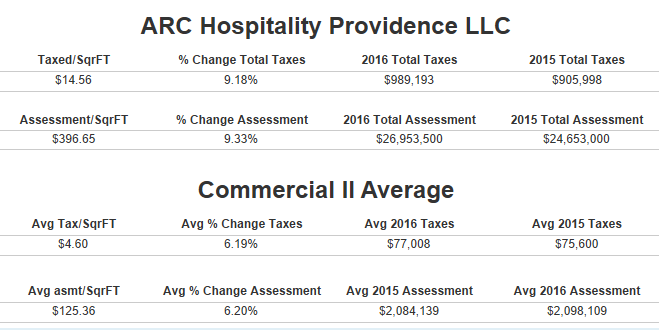
One of my first big Tableau projects was looking at property tax in Providence for 2015/2016.Click here for a link to the interactive viz. I used the Parcel Boundaries and Tax information data from OpenPVD Providence's open data portal and created an exploratory dashboard that allows people to find their property, view the tax information for 2015 and 2016, how it changed and give people the ability to compare it to the average for that same building tax class.

While OpenPVD doesn't provide square footage for parcels, they do have acre information for most properties. (about 5,000 are missing acre information) Converting the acre to square feet and coloring by how much each property is taxed/sqft really shows how the East Side stands out.

Don't be too bummed if your taxes were increased. 28,187 Properties had taxes increased about 71% and 8,295 about 23% saw no increase. I might revisit the 2017 information to see if anything changed at a later date.
Due to this being a shapefile of ~36,500 buildings it will probably run slow in the browser. So if you're interested in viewing it offline download the workbook PVD Taxes and Tableau Reader to run it on your machine locally.
If you'd rather not download that you can also check out this lighter version that looks at taxing across the different regions of providence interestingly there wasn't a single 2-5 family home in the Downtown region. This one lists the property owner and the tax information.
Lite Version
